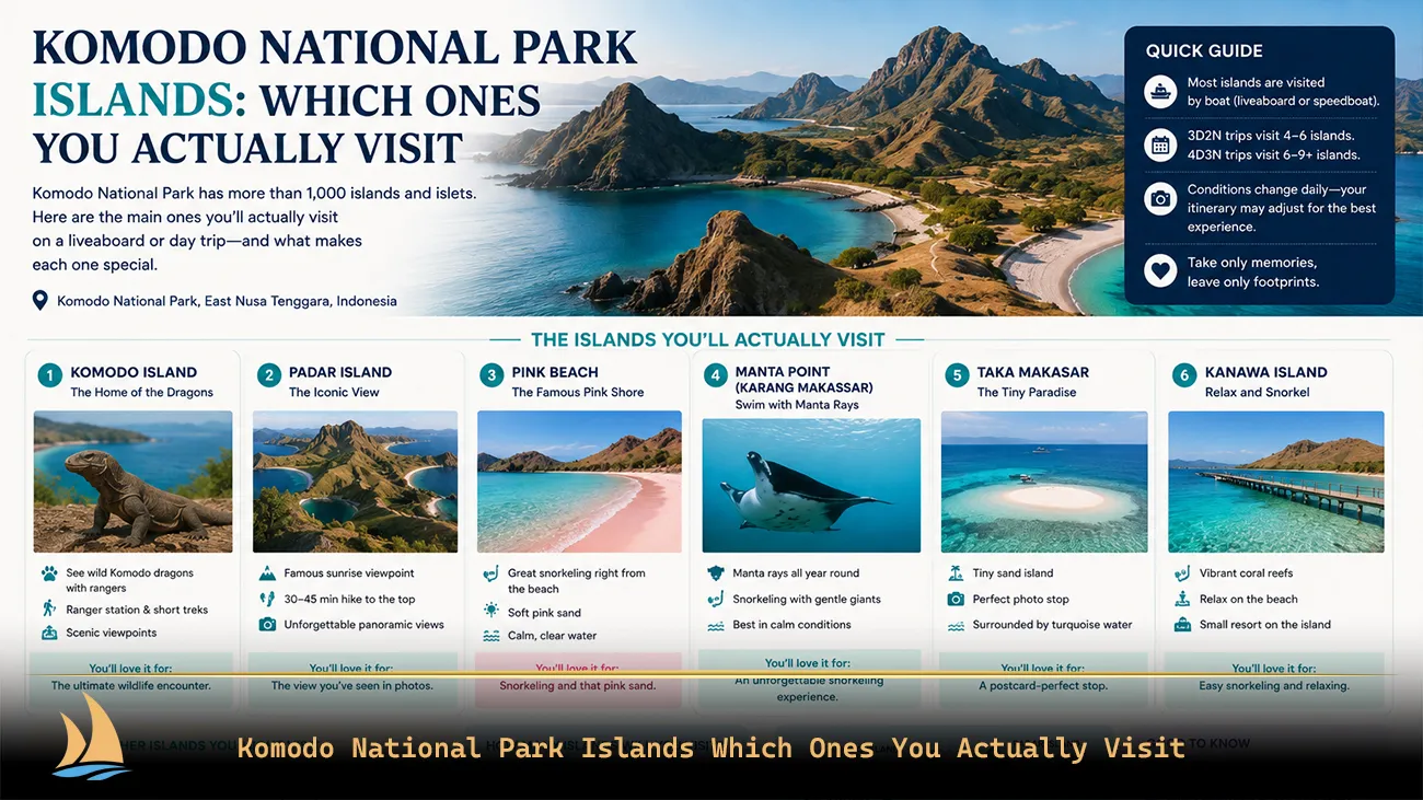

The short answer: Komodo National Park has three main islands — Komodo, Rinca and Padar — plus around 26 smaller ones. But the useful question is not which islands exist. It is which ones your boat can actually reach in the days you have. The park spans roughly 1,733 square kilometres, and the north-to-south distance is a serious passage rather than a hop. Almost every disappointing Komodo trip comes from someone underestimating that.
This guide maps the park the way a captain reads it: by sailing time, anchorage and reachable zone.
The Shape of the Park
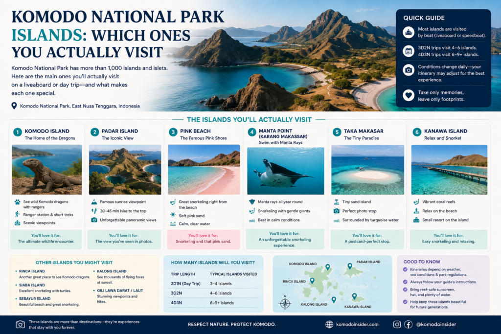
Four landmasses define it. Komodo Island sits west and is large — around 30 kilometres top to bottom. Rinca lies southeast, nearly as big. Padar is the small hourglass island wedged between them. And Flores forms the eastern boundary, with Labuan Bajo on its western tip.
Three straits organise the water between them, and knowing which one you are in explains most of what the sea is doing:
- Molo Strait — between Rinca and Flores. Every boat leaving Labuan Bajo crosses this first. Sheltered, easy, home to the near islands
- Lintah Strait — between Komodo and Padar. The central corridor, where water squeezing between two seas creates the currents that feed the park’s best marine sites
- Sape Strait — west of Komodo Island, facing Sumbawa. The most exposed water in the park and the least visited
The park is bounded by the Flores Sea to the north and the Sumba Sea to the south. That matters more than it sounds: cold, nutrient-rich water pushes up from the south, which is why the southern sites are colder, richer and completely different in character.
The Four Zones — and What Each Trip Length Reaches
This is the framing that actually helps you plan. Forget the island list; think in zones by distance from Labuan Bajo.
| Zone | Islands and sites | Reachable on |
|---|---|---|
| Near — Molo Strait | Kelor, Bidadari, Kanawa, Sabolan, Seraya, Sebayur, Papagaran | Day trip and up |
| Central — Lintah Strait | Padar, Pink Beach, Karang Makassar, Taka Makassar, Siaba, Tatawa, Loh Liang, Loh Buaya | Long day trip, comfortably on 3D2N |
| North | Gili Lawa Darat, Gili Lawa Laut, the northern seamounts | 3D2N at a push, properly on 4D3N |
| South | Nusa Kode, Horseshoe Bay, Gili Motang, Manta Alley, southern Komodo capes | 4D3N and longer, weather permitting |
The single most useful test you can apply to any itinerary you are sold: does it claim sites from two non-adjacent zones in one day? If a day trip promises the northern seamounts and the southern bays, the geography says it is not true.
Island Quick Reference
| Island | Why you stop | Dragons? | Typical time ashore |
|---|---|---|---|
| Komodo | Dragon trek at Loh Liang, Pink Beach | Yes — largest population | 1–2 hours |
| Rinca | Dragon trek at Loh Buaya | Yes — high density | 1–2 hours |
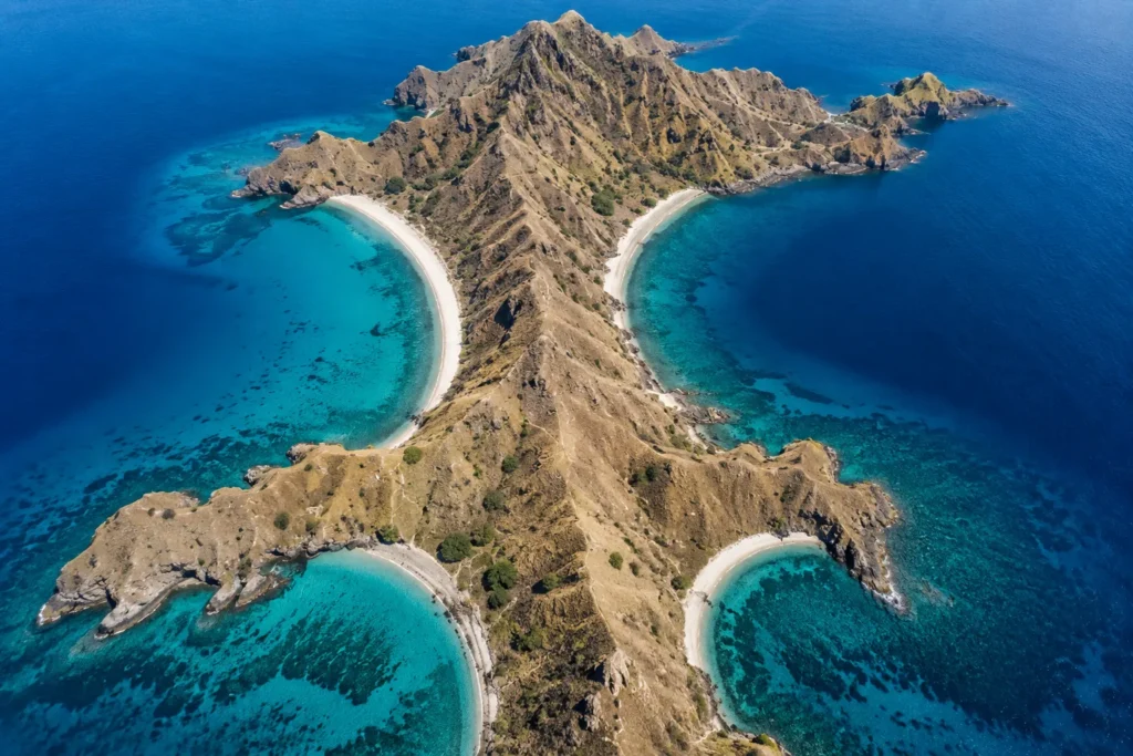
| Padar | Three-bay ridge viewpoint | No | 1.5–2 hours |
| Kelor | Short climb, first or last stop | No | 45–60 min |
| Kanawa / Sabolan | Sheltered snorkelling | No | 45–90 min |
| Taka Makassar | Sandbar, tide-dependent | No | 30–45 min |
| Kalong | Sunset bat migration | No | Viewed from deck |
| Gili Lawa Darat | Ridge hike, overnight anchorage | No | 1–2 hours |
| Gili Motang / Nusa Kode | Remote south, cold-water sites | Small population | Varies |
The Three Main Islands
Komodo Island
The largest island and the one the animal is named after. Rugged, dry, savannah-covered, with the park’s biggest dragon population. The ranger post at Loh Liang on the eastern side is where treks start.
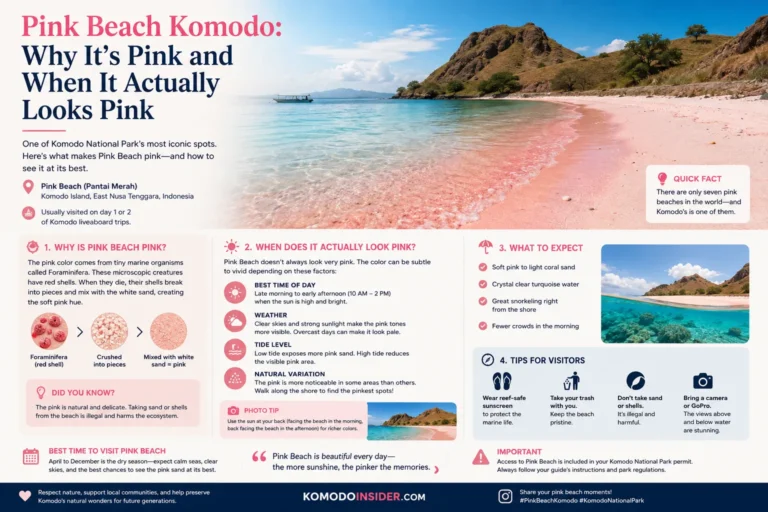
Pink Beach sits on the same island, which is why the two are almost always paired in an itinerary — a geographic convenience rather than a coincidence. The island’s southern capes reach into the cold Sumba Sea water and are a different world entirely, effectively liveaboard-only.
Rinca Island
Slightly smaller, closer to Labuan Bajo, and for most travellers the better dragon trek. The ranger post at Loh Buaya sits on the north coast with a short walk from the jetty, which is why day boats favour it.
Rinca also holds water buffalo, wild boar, macaques and megapode nesting mounds. Its southern coast, around Nusa Kode and Horseshoe Bay, is remote, cold-water and rarely visited.
Padar Island
Small, uninhabited, and the most photographed place in the park. The hourglass shape creates the three-bay viewpoint that appears on every Komodo brochure and on the Indonesian 50,000 rupiah note.
Padar has no meaningful dragon population — people are frequently surprised by this. You come for the ridge, and the ridge is worth it. Its position between Komodo and Rinca makes it the natural overnight anchorage for boats doing the classic central loop, which is precisely why sunrise there is only realistic on a multi-day trip.
The Smaller Islands You Will Actually Stop At
Most of a well-planned trip happens on islands nobody puts on a poster.
Kelor — closest to Labuan Bajo, a short steep climb to a view over the strait. Standard first or last stop.
Bidadari — near island with easy reef, often used as a warm-up snorkel.
Kanawa, Sabolan and Seraya — the sheltered eastern snorkelling islands. Calm water, good shallow coral, ideal for mixed-ability groups and nervous swimmers.
Sebayur — sits centrally on the eastern side, roughly twenty minutes from the central sites. Its position is why a resort was built there.
Taka Makassar — a crescent sandbar that emerges around low tide, next to Karang Makassar. Tide-dependent, so its inclusion in an itinerary is a tide-table decision, not a preference.
Kalong — the mangrove island where thousands of flying foxes lift off at dusk. Almost always the sunset stop on day one because it sits on the way back toward the sheltered anchorages.
Gili Lawa Darat — northern island with a ridge hike frequently mistaken for Padar in photographs. Its bays are among the busiest overnight anchorages in the park.
Papagaran — an inhabited fishing island, and the clearest window into how people actually live out here.
Gili Motang and Nusa Kode — far south, lightly visited, holding a small dragon population and cold, rich water.
What a Standard Three-Day Route Actually Covers
To make the zones concrete, here is the island set a typical 3D2N sailing works through, in geographic rather than chronological order:
- Near zone, day one: Kelor or Bidadari for a first swim, then Kalong at dusk
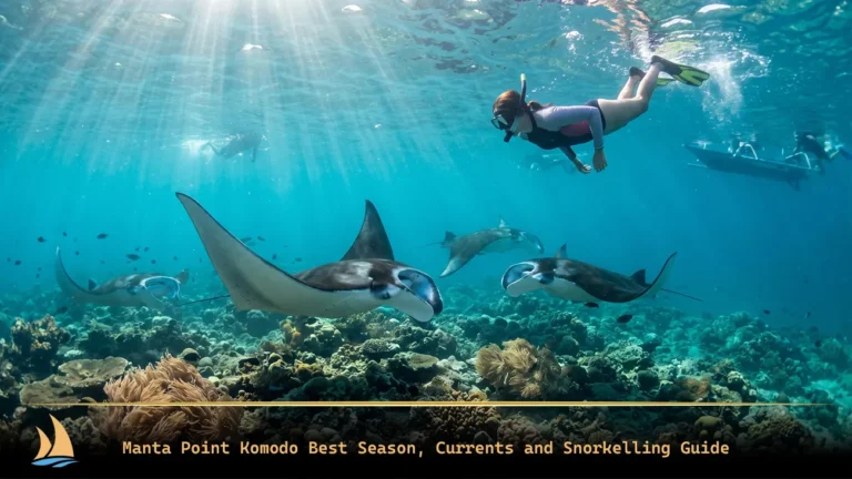
- Central zone, day two: Padar at dawn, Pink Beach on Komodo, a dragon trek at Loh Liang or Loh Buaya, Karang Makassar for mantas, Taka Makassar if the tide allows
- Near zone, day three: Kanawa, Sabolan or Sebayur on the way back in
That is six to eight islands, all within two adjacent zones. Notice what is absent: nothing northern, nothing southern. A three-day trip that promises Gili Lawa and the southern bays is describing a route that does not fit.
Islands People Expect to Find and Do Not
Three recurring confusions worth clearing up.
Padar has no dragons. It is the most photographed island in the park and the one most people assume is dragon territory. It is not.
The famous ridge photo is sometimes Gili Lawa, not Padar. The northern island’s hike produces a strikingly similar panorama and the two are frequently mislabelled online, including by tour listings.
Pink Beach is on Komodo Island. It is not a separate island, which is why it pairs with the Loh Liang trek. There are also other pink-sand beaches in the park; the one on most itineraries is the Komodo Island beach.
Where Boats Spend the Night
This is the part no other guide covers, and it determines your itinerary more than any list of sights.
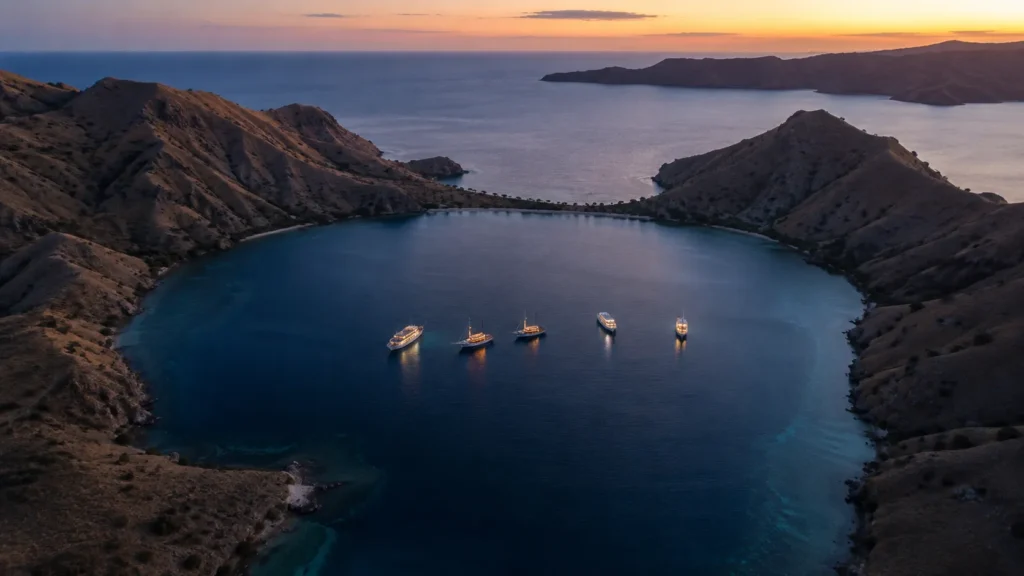
A multi-day sailing is not a series of destinations. It is a series of anchorages, with the sights arranged around them. Where your boat can safely spend the night dictates what you can reach at dawn the next morning — which is why the Padar sunrise depends entirely on where the vessel sits at 03:00, not on how early anyone is willing to wake up.
Anchorage selection depends on three things: shelter from the prevailing swell, holding ground for the anchor, and proximity to the next morning’s first stop. In the dry season the standard anchorages behind the islands are glassy. In the wet season swell wraps around headlands and the crew moves to different bays entirely — which is why wet-season itineraries get reshuffled and why that is a sign of competence rather than failure.
How Far Apart Things Really Are
Rough reference points, before you commit to any itinerary:
- The near islands — Kelor, Kanawa, Sebayur — are well under an hour from Labuan Bajo
- The central zone around Padar, Pink Beach and Karang Makassar is a significantly longer run, and is why single-day Padar trips involve a great deal of sitting on a boat
- The northern islands are a long day at best, and are normally reached by boats already overnighting inside the park
- The southern sites are an overnight passage. There is no day-trip version
Hull speed changes all of these substantially. A fast modern hull may cover in one hour what a heavy traditional phinisi covers in two and a half. That single difference is usually the real reason two similar-looking itineraries carry very different prices — and why a slower, more comfortable boat needs a longer trip to see the same things.
Our comparison of 2D1N, 3D2N and 4D3N itineraries maps trip lengths against these distances stop by stop.
How the Seasons Redraw the Map
The chart stays the same; the usable parts of it do not.
Dry season, roughly April to October. Most of the park is in play. Seas settle enough for the northern islands and the exposed western coast, visibility peaks, and crossings are comfortable.
Wet season, roughly December to March. The exposed edges effectively close. Wind and swell make the north and west unreliable and days get lost. What you gain is the year’s largest manta aggregations at Karang Makassar, because the plankton arrives with the rain. The sheltered eastern islands stay workable throughout.
The south is a special case — colder and richer year-round, and the most weather-dependent water in the park in any season.
Our month-by-month guide to the best time to visit Komodo National Park goes through the sea conditions in detail.
Where the Dragon Treks Start
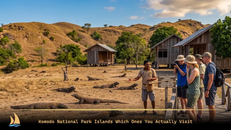
Dragon treks do not begin wherever you like. They start at two ranger posts: Loh Liang on Komodo Island and Loh Buaya on Rinca. A park ranger escorts every walk, and this is mandatory rather than optional.
Loh Buaya on Rinca is closer to Labuan Bajo with a shorter walk from the jetty, which is why day boats favour it. Loh Liang on Komodo is further out and feels less managed.
Since April 2026 each site also carries its own daily visitor allocation within the park-wide cap, and your permit is route-specific — so which island you trek is fixed when you book, not on the day. Our comparison of Komodo Island versus Rinca covers the choice, and our guide to permit booking under the quota system covers the mechanics.
Using Geography to Check an Itinerary
Before you book anything, run the itinerary against the zone table above. Three checks:
- Does it cross zones in a single day? Near-to-central is fine. North-to-south in one day is not possible
- Where does the boat anchor each night? This determines the dawn stops. A vague answer usually means the sunrise is not happening
- What kind of hull is it? A traditional phinisi on a two-night trip covers less ground than a fast boat on the same schedule
Any operator worth booking will answer all three without hesitation.
Why the Park Is Protected
Komodo National Park was established in 1980 to protect the Komodo dragon and was later designated a UNESCO World Heritage site. Its protection has since widened to cover the marine environment, which is arguably the more remarkable half — the straits sit within the Coral Triangle and carry exceptional reef and pelagic diversity.
This has practical consequences for visitors. Access is managed rather than open: ranger accompaniment is compulsory on the trekking islands, several zones are closed to visitors entirely, removing sand, shells or coral is prohibited, and since April 2026 daily visitor numbers are capped with entry pre-booked by route.
The restrictions are the reason the place still looks the way it does in the photographs.
Frequently Asked Questions
How many islands are in Komodo National Park?
Three main islands — Komodo, Rinca and Padar — plus roughly 26 smaller ones, along with the marine area between them. A standard three-day sailing typically stops at six to eight of them.
How big is Komodo National Park?
Around 1,733 square kilometres of land and sea. The scale is the thing travellers most often underestimate: the northern and southern extremes are an overnight passage apart, not a short hop.
Which islands can you visit in Komodo National Park?
Komodo and Rinca for dragon treks, Padar for the viewpoint, plus Pink Beach, Kelor, Kanawa, Taka Makassar, Kalong and others depending on your route. Access to each is set by your permit and your trip length.
Are there Komodo dragons on Padar Island?
Not in meaningful numbers, and sightings on the trekking route are very rare. Dragon treks happen only at Loh Liang on Komodo or Loh Buaya on Rinca.
Can you visit all the islands in one trip?
No. Reaching both the northern and southern extremes requires a longer liveaboard route, and the southern sites depend on settled weather. Most itineraries work one or two adjacent zones properly rather than covering everything badly.
Is Komodo National Park a UNESCO site?
Yes. It was established in 1980 to protect the Komodo dragon and later designated a UNESCO World Heritage site, with protection extending to the surrounding marine area.
Can you stay overnight on the islands?
There is no general visitor accommodation on Komodo, Rinca or Padar. Multi-day visitors sleep aboard their boat at anchor, which is why anchorage location shapes the itinerary so heavily.
Which island is closest to Labuan Bajo?
Kelor and Bidadari sit closest, well under an hour out, which is why they are the standard first or last stop on almost every route.
Planning Around the Geography
Once you understand the zones, the rest of the planning follows: which trip length reaches what, which months open which parts of the map, and how departure day works from Labuan Bajo. Browse Komodo tour packages or wider Indonesia liveaboard itineraries, or ask our team which route reaches the islands you care about.